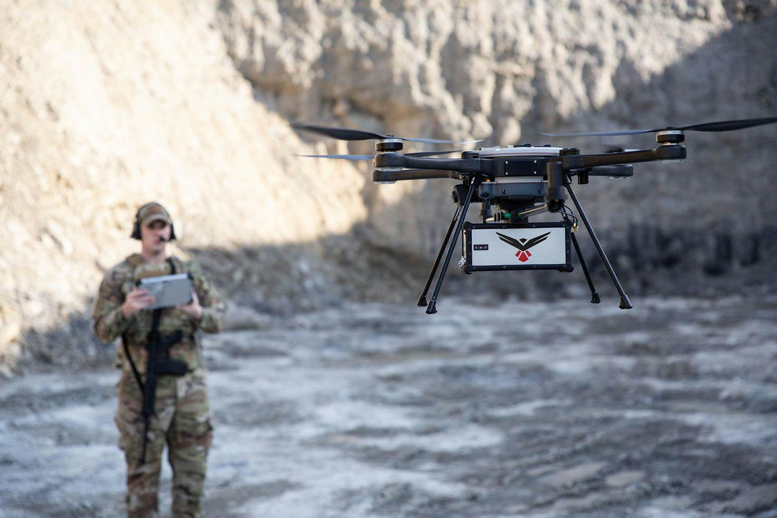
RedTail sUAS
LiDAR Systems
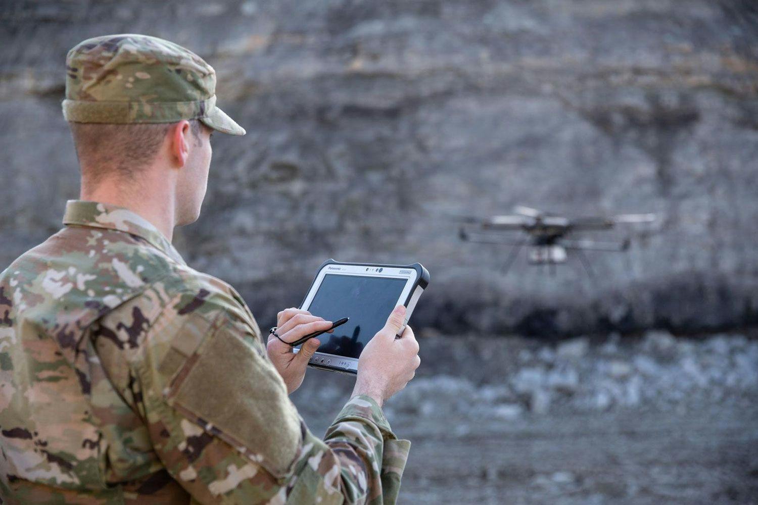
Government and Defense LiDAR Solutions.
Providing the absolute best solutions available for the United States Department of Defense and Government operations.


events
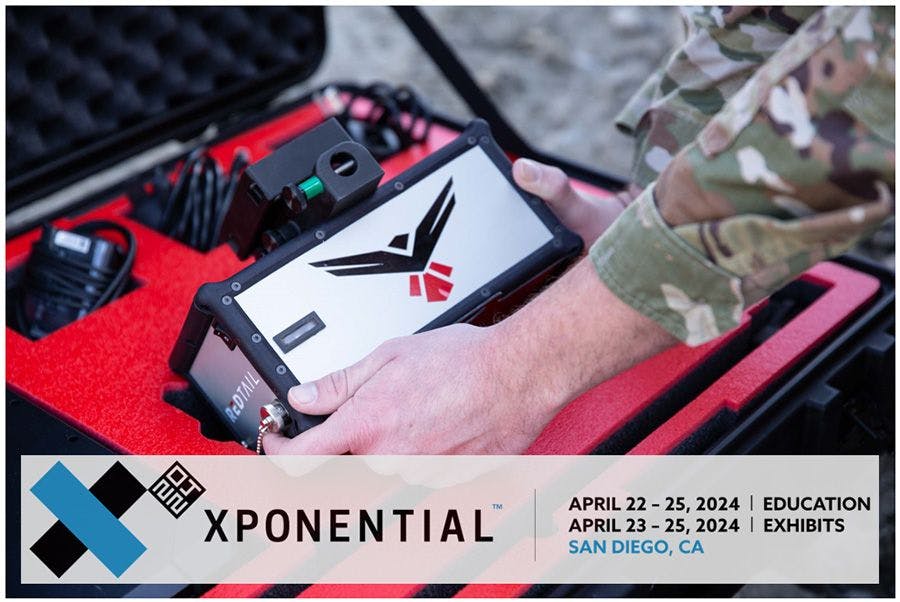
RedTail LiDAR Systems to Bring Cutting-edge 3D Sensing Technology to XPONENTIAL 2024
Read full article →

Scanning – The Way It Was Meant To Be™
The lightweight RTL-450 LiDAR system integrates onto multiple sUAS platforms and generates high-resolution point clouds for government and defense applications.

High Point Density
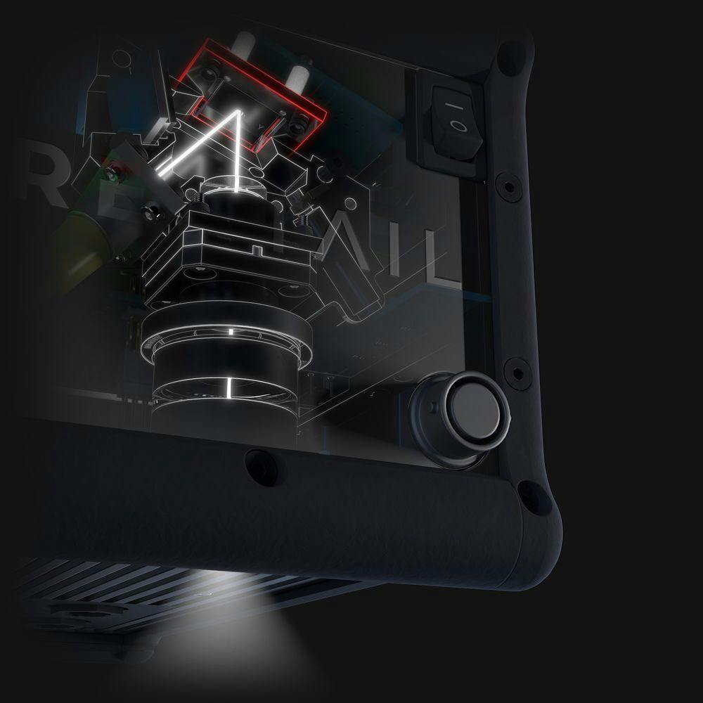
Proprietary MEMS mirror LiDAR technology allows all laser pulses to be transmitted to the ground.

Accuracy + Precision
The RTL-450 utilizes dual-antenna GPS to enhance point cloud accuracy even when flying at low speeds.

High-Resolution Images
Unrivaled data density and superior accuracy result in high-resolution point cloud images that capture details that competitors simply can’t.
Government and Defense LiDAR Solutions
The future of UAV LiDAR mapping has landed.
NDAA 848 Compliant | Safety Reviewed by U.S. Army Test and Evaluation Command | Laser Safety Approval by U.S. Army Public Health Center
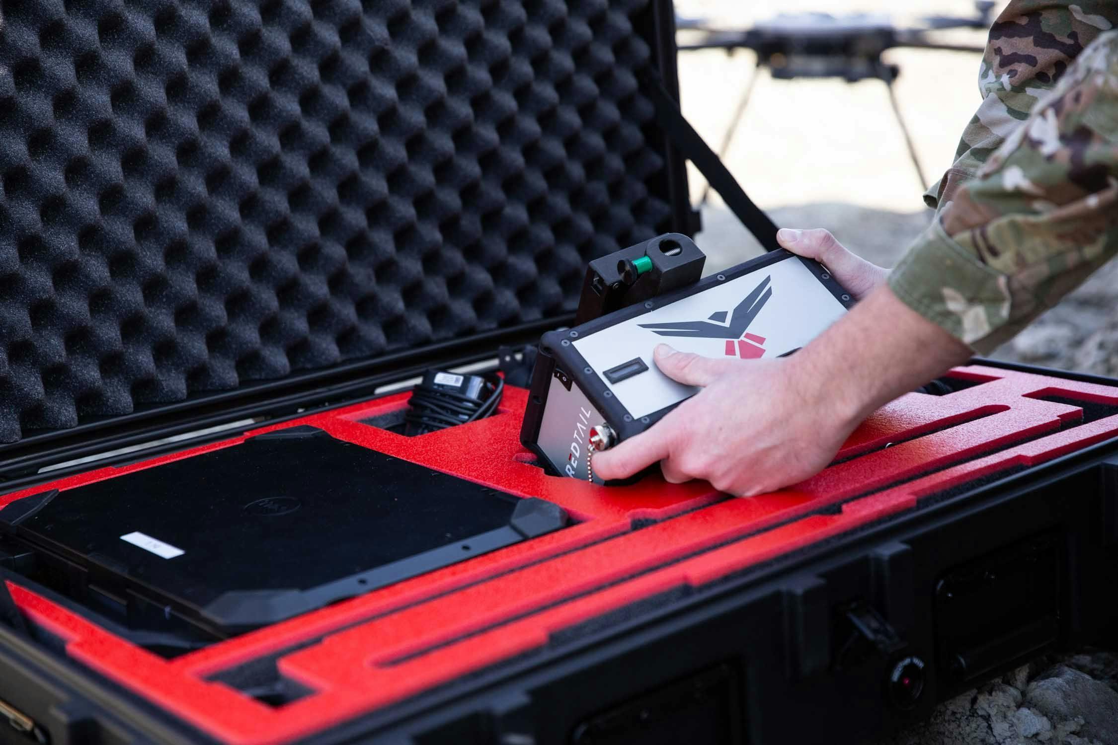
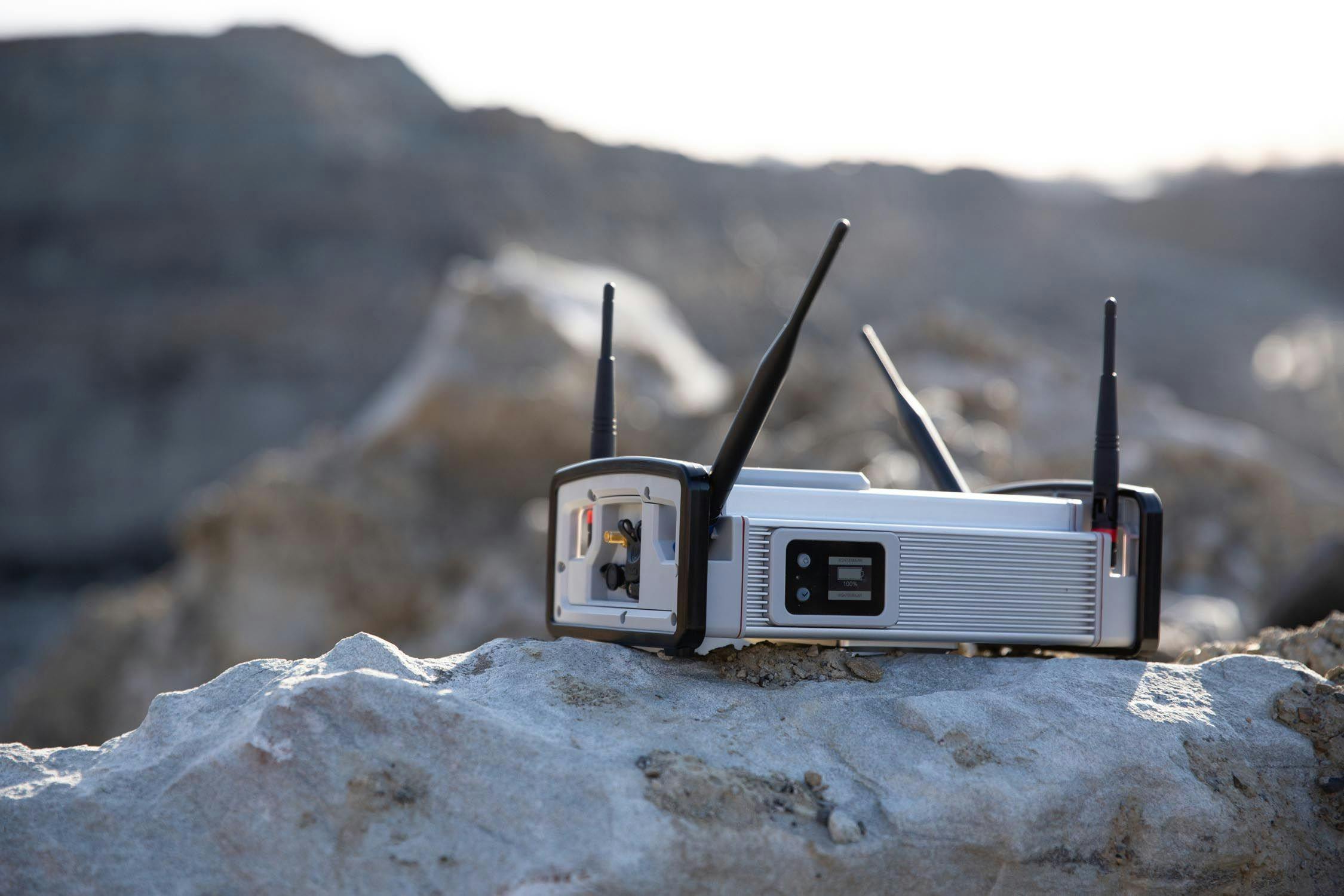
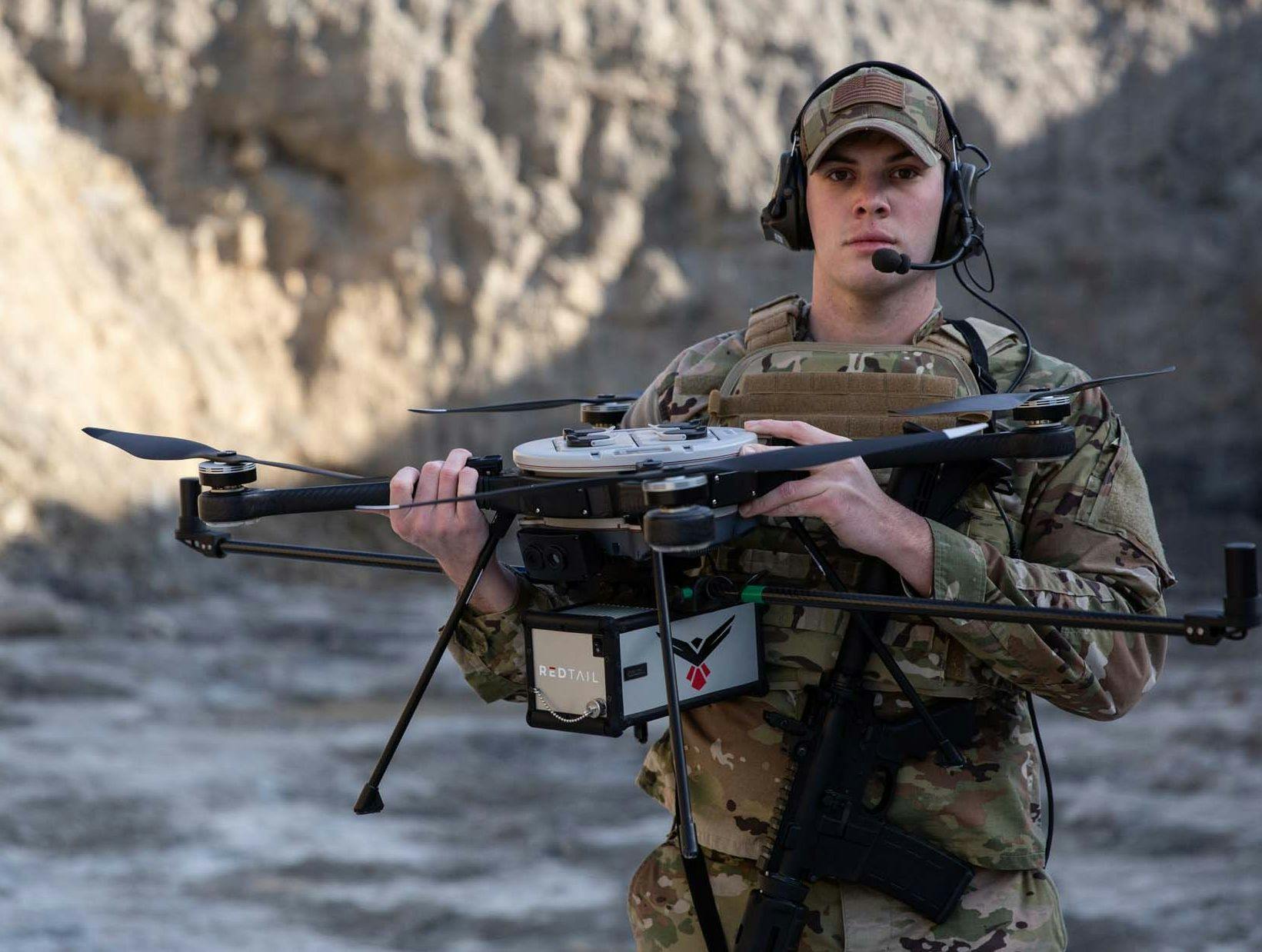
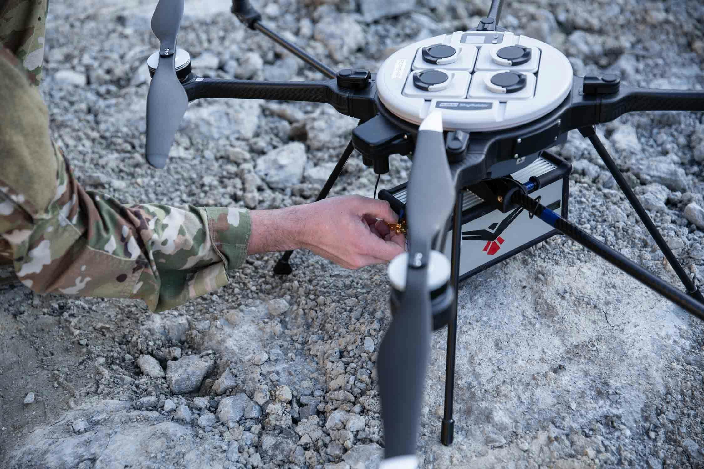
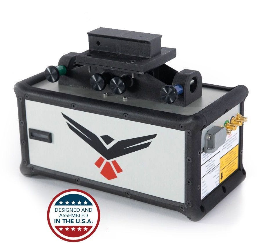
RedTail LiDAR System (RTL-450)
The innovative and lightweight RTL-450 is made in the USA and is designed to operate independently of the sUAS, facilitating quick and efficient integration onto user-selected sUAS platforms.
Specifications
| Lidar Unit Weight (with dual GPS Antenna) | 2.2 kg (4.8 lbs) |
| Dimensions | 9.4" L x 4.6" W x 4.6" H |
| Max Range to 20% Reflective Targets (e.g. grass, vegetation) | 120 meters (400 feet) |
| Max Range to 80% Reflective Targets (e.g. white surfaces) | 160 meters (525 feet) |
| Wavelength | 1550 nm |
| Pulse Repetition Rates | 100, 200, or 400 kHz |
| Scan Rate | 200 lines/sec |
| Returns Per Pulse | 3 |
| Measurement Rate | 1 million points/second |
| Power | 45 Watt |
| GNSS/IMU | Applanix APX-18 |
Customers


RedTail LiDAR technology licensed from the U.S. Army Research Laboratory; U.S. Patent Number 10,444,330 B2. Scanning - the way it was meant to be is a trademarked slogan of RedTail LiDAR Systems. Specifications are subject to change.